
By Cindy Hughes
To celebrate Preservation Month from home, we have launched Heart This Place – a new blog series from Historic Seattle staff. Each post will feature a different place that is significant to a member of our staff. In this installment, Council Assistant & GSC Rental Coordinator Cindy Hughes takes us on a tour of Queen Anne Boulevard:
30 years ago this month, my husband, infant daughter, and I moved to a shingled 1910 house located in the northern reaches of the historic Queen Anne Boulevard on Queen Anne Hill. I don’t think we realized at the time that we would be living on such a storied route – our actual new address was on 8th Ave. W. (no addresses are actually labeled “Queen Anne Boulevard,” they all correspond with the existing streets and the term is applied to the scenic route as a whole) and the area didn’t seem to have much in common with the celebrated Boulevard on the south slope of the hill.
Everyone knows that route for its expansive views and mansions built by timber barons and real estate magnates, but the Boulevard is more than the south brow of the hill – it reaches democratically north to encompass more modest blocks of builder’s bungalows and several small neighborhood business districts.
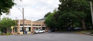
The little commercial district at 7th Ave. W. and W. McGraw St. with the Boulevard’s tree canopy embracing it from the south.
Over the years I have spent many hours venturing both north and south on the Boulevard from my house – walking, driving, bicycling, pushing strollers, waiting for school buses, walking dogs, and navigating its twists and turns as it stitches its way around the crest of the hill. Many of our visitors from out of town have experienced the walk with us south along the Wilcox Wall, past the Marshall Park Viewpoint and the grand estates along West Highland Drive, and ending at the iconic city and mountain viewpoint at Kerry Park. Less often I have headed north and then east along leafy streets with territorial views and sections where it would seem ironic to apply the designation of Boulevard at all.
But in the end it is the quieter north end of things that I am ending up appreciating, especially now that the Boulevard serves as my sanctioned close-to-home quarantine walk route during the COVID-19 pandemic. The rest of the city seems to have discovered the pieces to the south, but the crowds tend not to cluster north of West McGraw Street. These blocks represent recreation to me in a way they never did before, a way to get out of the house that now serves as a cramped workplace for three adults.
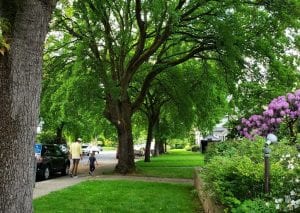
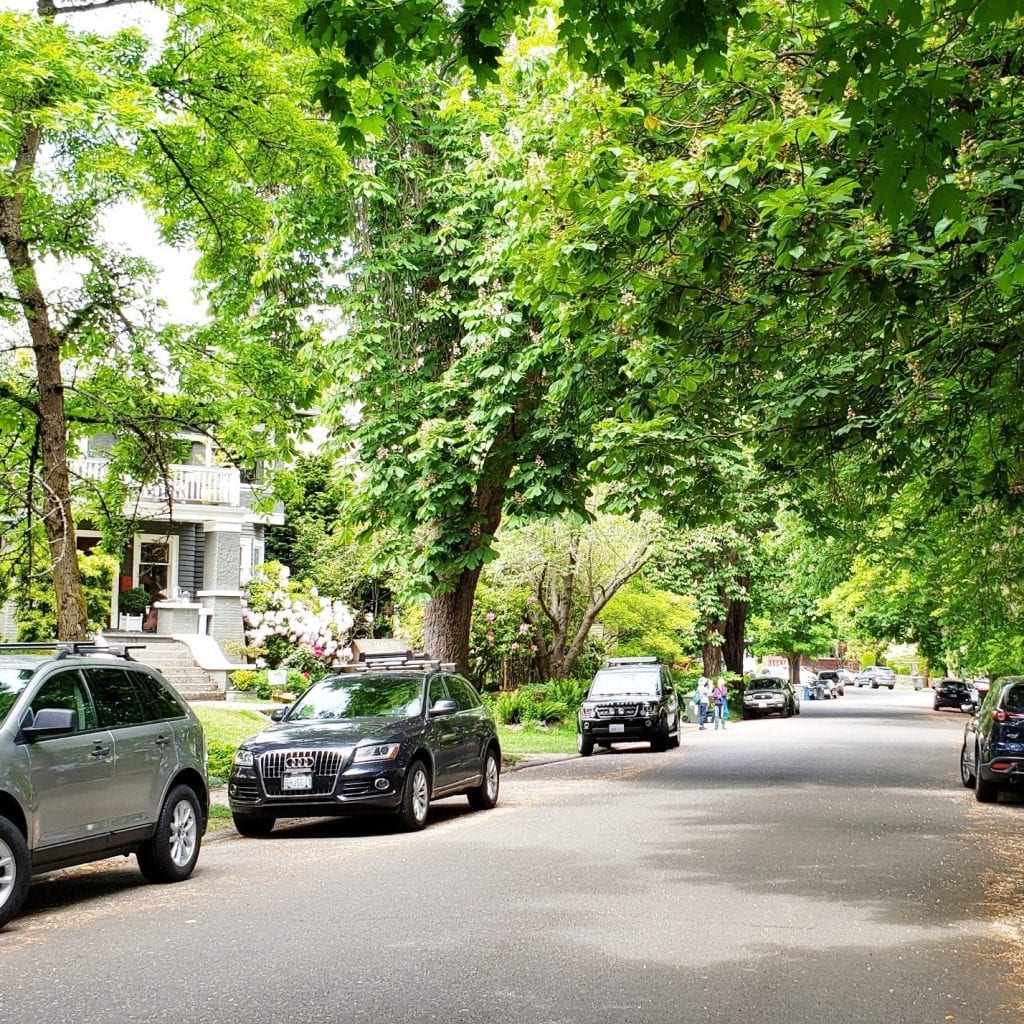
Montpelier Maples are a rare species of street tree lining this block of 8th Ave. W.
The legal description of Queen Anne Boulevard takes up two pages and gathers up 23 separate stretches of road ranging in length from one to eight blocks. The fact that the Boulevard runs along narrow, already-platted streets made it unique; it differed greatly from the other broad roadways in the Olmsted plan. The design that was worked out by the Parks Board, the City Engineering Office, and neighborhood residents called for six phases of development that took place between 1911 and 1916. The tree planting plan was not particularly well coordinated between phases, resulting in a charming variety of tree species – consistent on each individual block but different from one block to the next.
Some additional highlights of the Boulevard north of McGraw:
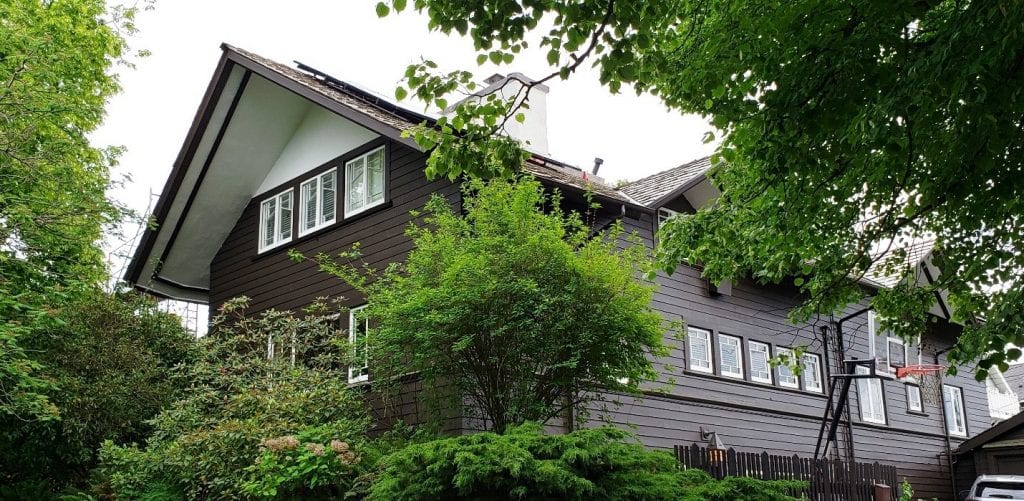
The 1910 Prairie-style Handschy/Kistler House at 9th Ave. W. & W. Wheeler St. – the only City of Seattle Landmark home located on the Boulevard on this side of the hill. The architect was Andrew Willatsen, a student of Frank Lloyd Wright.

This house at 9th Ave. W. & W. Fulton St. was featured in Jud Yoho’s 1916 pattern book, “The Bungalow Craftsman.”
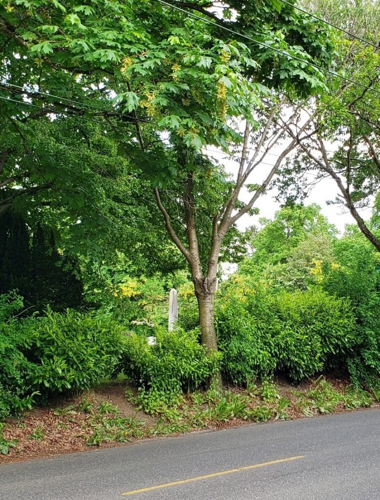
Peeking into Mt. Pleasant Cemetery as we round the curve back onto 8th Ave. W.
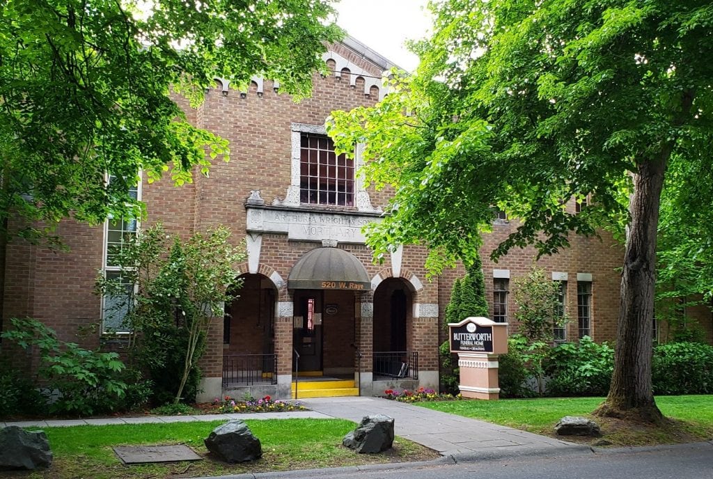
The venerable Arthur Wright Mortuary/Butterworth Funeral Home on W. Raye St.
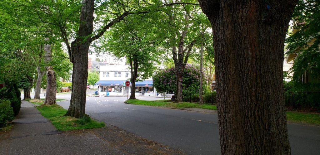
As W. McGraw Pl. emerges at a 5-way intersection onto W. McGraw St., we can see the 5 Corners Hardware Store. It’s been open and heavily frequented during the pandemic.
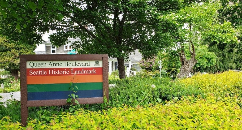
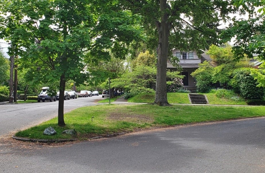
As the Boulevard snakes through the Seattle street grid, it creates a number of small triangles at various intersections. This one at W. Smith St. and First Ave. W. is heavily landscaped by Seattle Parks and Recreation and features a prominent identification sign.
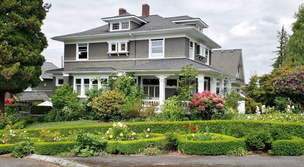
Foursquares were a popular architectural style on Queen Anne during the early years of the last century – this one is located at W. Smith St. and First Ave. W.
There are a number of stretches where the Boulevard doesn’t include sidewalks, especially along Wheeler and Bigelow Streets. Pedestrians are forced to walk in the street, which we are all doing anyway right now in order to socially distance ourselves. There is talk of closing at least part of the Boulevard to car traffic, under Seattle’s Stay Healthy Streets campaign begun during the pandemic.
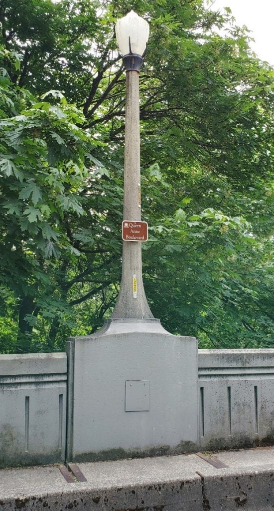
An acknowledgement of the Boulevard’s status along the McGraw Street Bridge.
This triangle displays the brown directional street signs that were installed just a few years ago to guide Boulevard travelers along its non-intuitive twists and turns.
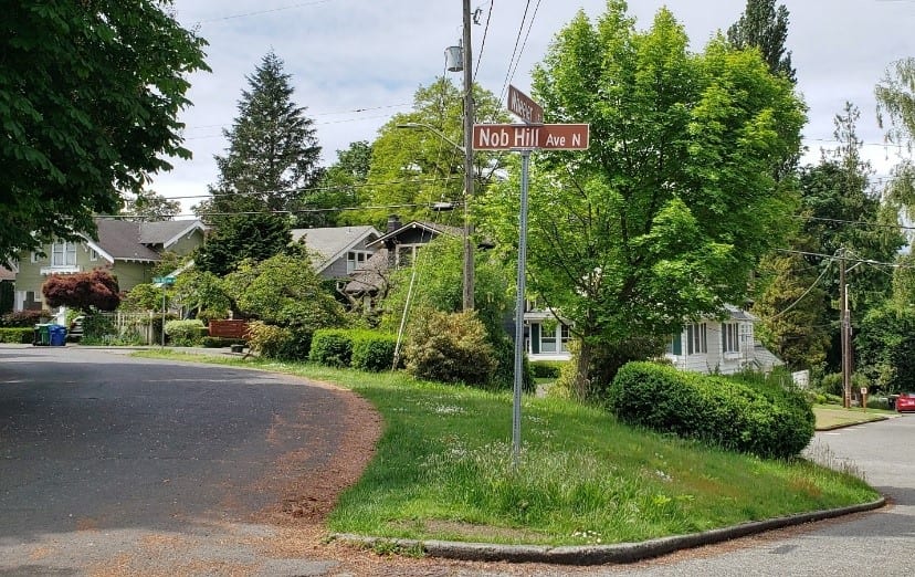
And one last look at yet another triangle created by the Boulevard’s energetic swoop along McGraw St. to Nob Hill Ave. N.
I am grateful to the community members of Queen Anne in the early part of the last century for bringing this remarkable streetscape to life, and to later historic preservation efforts to protect it and make it accessible to all. When this pandemic is all over it will continue to enrich our experience of the city, as it has done so well over the last 110 years.